 |
| CLICK ON THE PICTURE |
|
|
METHODOLOGIE
CLIQUEZ SUR LES IMAGES POUR LES AGRANDIR
|
EXAMPLES DE PAGES DE STATISTIQUES
CLIQUEZ SUR LES IMAGES POUR LES AGRANDIR
|
DESCRIPTION DU LIVRE
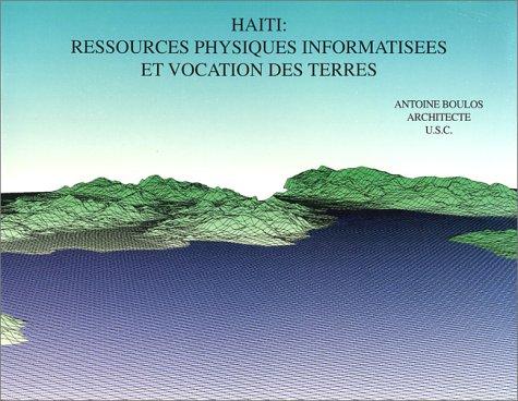
Ce livre est le résultat d'une recherche sur Haïti pendant 5 ans (sur ordinateur) par Antoine Boulos a l’école d architecture de l’Université de Californie du Sud (USC) à Los Angeles. Ce projet de recherche, sous la guidance du professeur Charles Steve Dwyer et avec la collaboration de l’architecte Gnok Lung Ha, est la transformation digitale d’Haïti en plus de 8, 000,000 de chiffres. Le but du projet était de diviser Haïti en cellules de 1 km² et de relever par Km², plus de 25 caractéristiques de terres telles que la topographie, l’écologie, les précipitations, la géologie, la lithologie, la couverture végétale, la population, les routes...Ces informations ont été ensuite analysées et superposées pour produire de nouvelles données sur Haïti :
Vues d Haïti en 3 dimensions, pentes, versants, drainage, hauteurs, exposition au soleil, études de visibilité, potentiel agricole pour plus de 25 cultures et beaucoup plus.
Le livre est de nature très graphiques et contient plus de 60 cartes sur Haïti, Chaque carte est accompagnée d’une page de référence montrant les résultats et les statistiques reliées a cette carte. La légende sur les cartes est en anglais et sur les pages de statistiques, en Français. Bien qu’écris en français, la nature graphique du livre le rend accessible à toute personne dont le français n’est pas La langue maternelle.
BOOK DESCRIPTION
This book is the compilation of a 5-year computer research project on HAITI by Antoine Boulos at the University of Southern California, School of Architecture in Los Angeles, CA. This research project, under the guidance of Professor Charles Steve Dwyer and with the collaboration of Architect Ngok Lung Ha, is a compilation of more than 8,000,000 numbers that were analyzed and digitized into the system. The project goal was to divide Haiti in cells of 1 square km, followed by the recording, per square kilometer, of more than 25 land characteristics such as topography, ecology, precipitations, geology, lithology, vegetal cover, population, roads... These informations were then analyzed and superimposed to produce new data for Haiti such as:
3-Dimensional Views of Haiti / Slope Map / Aspect Map / Drainage Map / Elevations Map / Solar Exposure Maps / Visibily Studies / Agricultural Potential maps for more than 20 crops and much more.
The book is very graphical and contains more than 60 glossy maps of Haiti. Each map represented is accompanied by a reference page showing results & statistics relating to that map. The legend on the maps is in English (on the map) and in French (on the statistic page). Although written in French, the
graphical nature of the book makes it accessible to any non-French speaking individual.
PURCHASE INFORMATION:
WORLDWIDE : WWW.AMAZON.COM
HAITI: DESIGN-1, LIBRAIRIE AUGUSTE, LIBRAIRIE LA PLEIADE
|
|